Astronaut Reveals Enigmatic Rock Rings in Sahara Desert
Astronaut Reveals Enigmatic Rock Rings in Sahara Desert
An astronaut aboard the International Space Station (ISS) has recently captured stunning images of a series of colossal, mysterious rock rings deeply embedded within the remote expanses of the Sahara Desert. This unexpected geological feature, observed from Earth's orbit, has immediately piqued the interest of geologists and planetary scientists worldwide, prompting urgent calls for further investigation into its origins.
Background: A New Perspective from Orbit
The International Space Station serves as a unique platform for observing Earth, offering astronauts unparalleled views of our planet's diverse landscapes. Astronauts routinely photograph Earth's surface, contributing to a vast archive of images that aid in climate monitoring, environmental studies, and geological mapping. These orbital vantage points often reveal features invisible or poorly understood from ground level.
The Astronaut’s Vantage Point
The discovery was made by an unnamed astronaut during Expedition 70, a standard mission focusing on scientific research and Earth observation. While performing routine photographic duties over North Africa in early 2024, the astronaut's keen eye discerned an anomalous pattern amidst the familiar ochre and brown hues of the Sahara. The clarity and distinctiveness of the concentric circles stood out against the vast, undulating desert sands, prompting immediate documentation and relay to ground control at NASA's Johnson Space Center in Houston, Texas.
For decades, space-based imagery has revolutionized our understanding of Earth's geology. Features like the Richat Structure in Mauritania, often called the "Eye of the Sahara," were first properly appreciated and studied through satellite photos and astronaut observations. This ancient, deeply eroded dome, spanning nearly 50 kilometers, serves as a prime example of how orbital perspectives unveil Earth's hidden geological masterpieces. The new discovery, while distinct from the Richat Structure, shares the mystique of being a monumental geological anomaly.
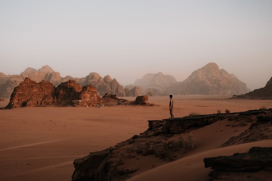
The Sahara Desert itself is a geological marvel. Stretching over 9.2 million square kilometers, it is the largest hot desert in the world, characterized by extreme aridity and vast stretches of sand dunes, rocky plateaus, and ancient riverbeds. Beneath its shifting sands lie billions of years of geological history, including evidence of ancient seas, volcanic activity, and tectonic movements. This makes the Sahara a fertile ground for unexpected discoveries, where erosion and desertification can gradually unveil long-hidden formations.
Initial reports from the ISS crew indicated the formations were unlike typical desert landforms, prompting geologists to prioritize their analysis. The precise location, initially kept under wraps for scientific verification, has since been confirmed to be in a particularly remote and uninhabited region of the central Sahara, far from established tracks or settlements, further underscoring the challenge and excitement of its discovery.
Key Developments: Unpacking the Enigma
Following the astronaut's initial photographic evidence, high-resolution satellite imagery from various international agencies, including the European Space Agency (ESA) and the United States Geological Survey (USGS), was quickly tasked to capture more detailed views of the mysterious rings. These subsequent images have provided a clearer picture, allowing scientists to begin formulating preliminary hypotheses.
Initial Geological Assessments
The newly discovered rock formation consists of at least three distinct, near-perfect concentric circles, with the outermost ring estimated to span approximately 7 to 10 kilometers in diameter. The rings appear to be composed of different rock types, exhibiting varying shades of dark grey, reddish-brown, and lighter beige, suggesting differential erosion of distinct geological layers. The central area of the formation shows signs of uplift or a collapsed structure, hinting at complex subterranean processes.
Geologists at institutions like the Scripps Institution of Oceanography and the Sorbonne University have expressed a mixture of awe and bewilderment. Dr. Elena Petrova, a geomorphologist specializing in arid environments, remarked, "The symmetry is striking, almost too perfect for natural processes at first glance. Yet, Earth has a way of sculpting incredible patterns over geological timescales." The formations are clearly deeply eroded, indicating immense age, potentially millions to hundreds of millions of years old.
Unlike the Richat Structure, which is a classic dome, these new rings appear to be more defined by sharp, circular ridges and depressions, suggesting a different genesis. The surrounding desert landscape shows no obvious signs of recent tectonic activity or widespread volcanic flows that would readily explain such a localized, circular feature, adding to the scientific puzzle.
Leading Scientific Hypotheses
Several leading hypotheses are currently being debated within the geological community:
1. Deeply Eroded Impact Crater: One prominent theory suggests the rings are the remnants of a very ancient, deeply eroded meteor impact structure. Over millions of years, the impact crater would have filled with sediment, and subsequent erosion would have preferentially removed softer layers, exposing harder, concentric rings formed by the shockwaves and subsequent geological infill. The immense scale and circularity lend some credence to this idea, though direct evidence like shock metamorphism or impact melt rocks would require ground sampling.
2. Ancient Volcanic Caldera or Ring Dike Complex: Another compelling hypothesis posits that the rings represent the eroded remains of a massive, ancient volcanic caldera or a complex system of ring dikes. Calderas form when a volcano collapses into its emptied magma chamber, creating a large, circular depression. Ring dikes are intrusive igneous formations that occur in concentric patterns around a central magmatic intrusion. The varying rock types observed could correspond to different volcanic or intrusive phases. This theory aligns with the Sahara's history of intermittent volcanic activity in certain regions.
3. Tectonic Uplift and Differential Erosion: A third theory attributes the formation to tectonic forces. A localized dome of sedimentary or metamorphic rock could have been uplifted over geological time. Subsequent erosion by wind and water, acting on layers of varying hardness, would then carve out the concentric patterns. This process is common in many parts of the world, but the extreme regularity of these rings makes it a less straightforward explanation without specific underlying geological structures.
4. Hydrothermal Vent System: A more speculative but intriguing idea suggests the rings could be related to an ancient, deep-seated hydrothermal system. Mineral-rich fluids rising through cracks in the Earth's crust could have deposited concentric layers of minerals, which were later exposed by erosion. Such systems are known to create unique geological formations, but typically on a smaller scale or with less pronounced circularity.
To further analyze these possibilities, scientists are utilizing advanced remote sensing techniques. Synthetic Aperture Radar (SAR) data, capable of penetrating dry sand to reveal subsurface structures, is being employed to map the underground architecture of the rings. Hyperspectral imaging is also underway to identify the precise mineralogical composition of the exposed rock layers, which could provide crucial clues to their genesis.
Impact: Reshaping Our Geological Narrative
The discovery of these enigmatic rock rings holds significant implications across various scientific disciplines, inspiring new research directions and potentially altering our understanding of Earth's ancient geological processes. The ripple effect extends from academic research to public engagement, highlighting the continuous marvels our planet holds.
Shifting Geological Paradigms
For the geological community, this find is a major event. It offers a pristine, large-scale example of an as-yet-unexplained geological feature, challenging existing models of desert geomorphology and crustal evolution in North Africa. Geologists will be forced to re-evaluate the deep time history of the Sahara, potentially uncovering previously unknown periods of intense geological activity, whether volcanic, impact-related, or tectonic.
Planetary scientists are also closely monitoring developments. Earth-based geological structures, especially those in extreme environments like the Sahara, often serve as analogs for features observed on other planets, particularly Mars. The search for ancient water and geological processes on Mars frequently relies on understanding similar phenomena on Earth. If the rings prove to be an ancient impact crater or volcanic caldera, they could provide valuable insights into identifying and interpreting similar structures on the Martian surface, aiding future robotic and human missions.
While the primary hypotheses lean towards geological origins, archaeologists and anthropologists are also keeping a watchful eye. Although the scale and apparent age of the rings make an anthropogenic origin highly improbable, any ground expedition would naturally include experts to assess for any signs of ancient human presence or interaction with such a unique landscape, however unlikely.
Inspiring Public Curiosity
Beyond the scientific community, the discovery has captured public imagination. News of an astronaut-discovered mystery in one of Earth's most remote regions resonates with a sense of adventure and wonder. It serves as a powerful reminder of the vast, unexplored beauty and complexity of our home planet, even in an age of extensive mapping and satellite coverage. This public interest can translate into greater support for scientific research, space exploration, and environmental conservation.
Long-term, if the site is deemed geologically significant and accessible, it could potentially become a focus for geotourism, drawing visitors interested in unique natural formations. However, given its extreme remoteness and the delicate nature of such a site, any tourism development would require careful planning and strict environmental protection measures to preserve its integrity.
Moreover, the discovery underscores the invaluable role of human observation from space. While automated satellites provide vast amounts of data, the human eye, with its capacity for pattern recognition and anomaly detection, often makes the initial breakthrough. This synergy between human intuition and technological capability remains a cornerstone of space exploration and Earth observation.
What Next: The Road to Discovery
The immediate priority for the scientific community is to transition from remote sensing analysis to direct, on-the-ground investigation. This next phase will be crucial in definitively determining the origin of the mysterious Sahara rings.
Planning the Expedition
Organizing a ground expedition to such a remote and challenging region of the Sahara Desert presents significant logistical hurdles. Teams of geologists, geophysicists, and support personnel would need to be equipped for extreme heat, limited water resources, and difficult terrain. Specialized vehicles, satellite communication, and robust safety protocols would be essential. Funding for such an ambitious undertaking is already being sought from national science foundations and international collaborative programs.
The primary objectives of a ground expedition would include: Direct Rock Sampling: Collecting rock samples from various points within and around the rings for petrographic analysis, radiometric dating, and geochemical testing. This would reveal the exact mineral composition, age, and formation conditions.
Geophysical Surveys: Conducting seismic surveys, gravity measurements, and magnetic anomaly mapping to probe the subsurface structure and determine the depth and extent of the geological features.
Detailed Topographical Mapping: Using drones and advanced GPS equipment to create ultra-high-resolution 3D maps of the entire formation, identifying subtle features and variations not visible from orbit.
Environmental Assessment: Studying the unique desert ecosystem surrounding the rings, which might offer insights into long-term environmental stability or change in the region.
International collaboration is anticipated to be a hallmark of this research effort. Agencies like NASA, ESA, the French National Centre for Scientific Research (CNRS), and various African geological surveys are expected to pool resources and expertise. This collaborative model ensures a comprehensive approach and fosters a global scientific exchange, vital for understanding such a significant discovery.
Global Scientific Collaboration
Once samples are collected and data acquired, the subsequent phase will involve extensive laboratory analysis and computational modeling. Experts in impact geology, volcanology, structural geology, and desert geomorphology will converge to interpret the findings. The results will be disseminated through peer-reviewed scientific journals, international conferences, and public outreach initiatives.
The long-term implications of unraveling this mystery are profound. It could lead to a revision of geological maps of North Africa, providing new insights into the ancient tectonics of the African continent. Furthermore, understanding the processes that formed these rings could inform our search for similar structures on other celestial bodies, refining our methods for identifying potential sites of past volcanic activity or ancient impacts on planets like Mars or moons like Europa.
The astronaut's serendipitous observation has opened a new chapter in Earth's geological story. From a distant vantage point in orbit, a hidden wonder has been unveiled, reminding us that even in our well-mapped world, profound mysteries await discovery, beckoning scientists and explorers to embark on new journeys of understanding.